Secure land management, tailored to your challenges
Mapping, cadastral records, land rights: a modular platform to secure, modernize, and enhance land management for governments, local authorities, and private operators in France and around the world.
Your land management challenges
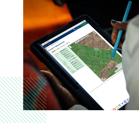
Securing property rights, modernizing land administration, and managing complex land assets: every stakeholder in the land sector faces specific challenges. OneLand® addresses these challenges with a configurable, modular, and interoperable solution.

The OneLand® solution:
modules that adapt
to your needs
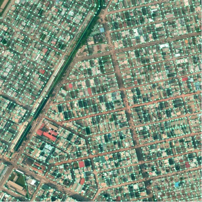
Three complementary and interoperable modules that can be combined according to the specific characteristics and needs of your land management project and that cover all aspects of land management.


Optimising field data collection
- Intuitive collection system that can be deployed anywhere
- Land tenure and socio-economic surveys and parcel delineation at any scale
- Built-in quality control to ensure reliable data from the point of collection
- Automatic, secure generation of land deeds
- A user-friendly interface for rapid adoption
- Dynamic, customizable reports for informed decision-making

Facilitating day-to-day land management,
from municipality to Ministry
- Management and monitoring of land procedures
- Integration of existing archives and plans
- Automatic generation of administrative, land and mapping documents
- Registration and preservation of rights and deeds
- Maintenance of the digital parcel map
- Traceability and decision-support tools
- Management of transaction fees, payments, and related invoices

Simplifying access to land information
and procedures for users
- Portals and mobile applications for the general public and professionals
- Dedicated services for professionals, including surveyors, developers, investors, banks, notaries, etc.
- Digital portal for submitting and tracking requests
- Integration of national services, such as digital identity, electronic signature, document certification and online payment
- Search and consult land information through an interactive online map
Our land management projects in France and internationally
Learn about some of our projects involving the implementation of land management platforms and consulting services.
Nationwide modernization of land administration
Ministry of Lands and Housing Development – Zanzibar
The LARIS (Land Administration Registration Information System) project aims to modernize and digitize land administration in order to secure property rights, reduce land disputes, and improve the efficiency of public services by establishing a solid foundation of geographic data, digitizing all land-related documentation, deploying a land information system, and conducting large-scale property certification.


Implementation of a Land management information system
Office du Niger – Mali
The mission’s primary objective was to implement Component III of the N’Débougou IV project, “Land Governance,” which focused on one of the key recommendations of the 2018 external land audit: adapting the organization and tools to address current land-related challenges in the Office du Niger region. The N’Débougou area, in particular, benefited from the design, development, and deployment of a Land Information and Management System (SIGEF).
Integrated urban land management system
Ministry of Construction, Housing, and Urban Planning – Ivory Coast
The project to streamline and digitally transform urban land management aimed to speed up the process of issuing administrative documents, secure land information, and improve the business environment in Côte d’Ivoire. The goal was to implement the Integrated Urban Land Management System (SIGFU).
Design and implementation of a recording system
Office of the Attorney General and Legal Affairs – Trinidad and Tobago
The main objective of the project was to strengthen information management and institutional capacity within the General Registry Department by designing, developing, and implementing the Property Business Registration System (PBRS), while integrating legal data from various systems into it.
Implementation of the national land information system
Ministry of Lands, Housing, and Urban Development – Uganda
The Ministry of Lands, Housing, and Urban Development, with support from IGN FI, has launched a public web portal and mobile apps based on the country’s national land information system. This tool improves users’ access to land information and promotes transparency and security in Uganda.
Large-scale land certification initiative and support for land service desks
Ministry of Agriculture and Livestock – Madagascar
In 2016, the Malagasy government, with support from the World Bank, launched the Agricultural Growth and Land Tenure Security Project (CASEF). This ambitious project combined community mobilization, training, technological innovations, and methodological approaches to accelerate the large-scale issuance of land titles and help secure land parcels.
Securing land rights
Landscape Restoration and Resilience Project – Burundi
The land subcomponent of the PRRPB aims to clarify and secure land rights, as well as to resolve land conflicts in the municipalities and hill regions where the project is being implemented. Securing land rights and reducing land conflicts are therefore among the factors that contribute to sustainable agricultural and rural development.
Detailed design, development, and implementation of a rural land information system
Rural Land Agency – Ivory Coast
The Rural Land Agency (AFOR), the project owner for several land tenure security projects in Ivory Coast, including the World Bank-funded PAMOFOR project (goal: 54,000 land titles in 5 years across 6 regions), has decided to modernize its land information system. It has entrusted IGN FI with the design, development, and deployment of a new application to manage this system.
Design, delivery, and implementation of a land information system
Ministry of Lands, Housing, and Human Settlements Development – Tanzania
The main objective of the ILMIS project was to modernize the entire land administration process by developing tools for land title registration in order to secure property rights for the people of Tanzania.
Design and development of the national cadastral information system
Ministry of Agriculture, Livestock, Aquaculture, and Fisheries – Ecuador
The project focused on the design, development, and implementation of the national land administration system based on existing applications, using open-source tools and open standards, as well as on the architecture and design of one of the national territorial agencies.
Project to support Urban Land Management Reform (PAGEF)
Ministry of Economy, Finance, and Planning, National Authorizing Officer for the EDF – Senegal
L’objectif du projet consistait en une étude des procédures foncières, la modélisation du système foncier et la proposition de cahier des charges pour l’informatisation. Un appel d’offres a été lancé pour la suite pour développer un système de gestion foncière (SGF) sur trois sites pilotes, qui englobe quatre composantes : domaniale, cadastrale, conservation foncière et fiscale.
Why choose OneLand®?
A solution designed to last, adapt, and support every stage of your land management.

Interoperability
100% sovereign solution, interoperable and compliant
with international standards (LADM/OGC/ISO 19152).

Innovation
AI, blockchain, secure architectures that ensure
reliability, traceability and performance.

Adaptability
Independent modules that can be selected and
connected according to your needs and project
complexity.

Scalability
A solution designed to keep pace with business, technical and regulatory changes.

Rapid deployment
Intuitive interface, configurable without coding,
immediate onboarding and efficient implementation.

Support
A multidisciplinary team of seasoned experts will stand by your side at every step, from the feasibility study through deployment and change management.
About
The result of more than 20 years of expertise in France and internationally, OneLand® is a solution developed by IGN FI, an expert in international geographic engineering, and NEOGEO, a designer and integrator of geospatial solutions. Both entities are subsidiaries of the GEOFIT Group, a major European player with expertise across the entire geographic data lifecycle.

Do you have a question or a land management project? Let's talk about it
Contact our digital land management experts to discuss your needs and learn how OneLand® can meet them.
